SwordFish_13
Active member
Hi,
PEace
-=SF_13=-
Source:BBC News
India has launched its first satellites to be used for helping mapmakers and amateur radio operators.

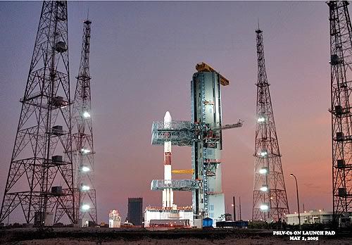
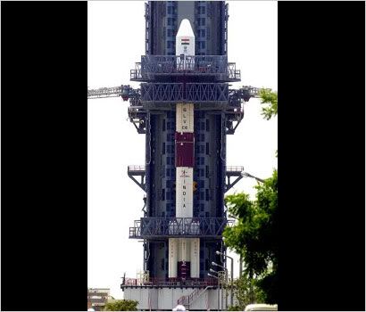
The satellites were launched on an Indian-made rocket
The Cartosat, weighing 1.5 tonnes, will supply data that will enable maps precise enough to detail every house in the country.
The Hamsat, weighing about 42.5kg, will help expand bandwidth to help amateur radio operators around the world.
India hopes Thursday's launch will help the country break into the lucrative commercial satellite launch market.
The satellites were sent into space on a locally-made rocket from Sriharikota island in southern Andhra Pradesh state.
"The launch took place exactly on schedule," S Krishnamurthy, a spokesman for the state-run Indian Space Research Organisation (Isro) said, the AFP news agency reports.
Stiff resistance
The launch was attended by Indian President APJ Kalam, a scientist himself who was once involved with India's satellite programme.
Amateur radio operators have greeted the Hamsat as it will provide very high radio frequencies to expand ham operators.
The satellite is "India's contribution" to Ham radio operators all over the world for the services after the tsunami in December, Mr Krishnamurthy told the BBC.
Amateur radio operators in India have been active since 1950s but face stiff government restrictions.
Until last year, they were banned from functioning in India's Andaman and Nicobar islands by the defence ministry.
The government lifted the restrictions barely a fortnight before December's tsunami, which hit the islands badly.
Two Indian operators who landed in the islands after the ban was lifted eventually played a major role in getting relief across to the affected people in the islands.
The bigger Cartosat satellite is expected to supply high resolution pictures for making precise maps which would be used in planning towns and disaster assessment, among other things.
Last September, India launched a satellite to be used for expanding the country's educational network.
In September 2002, India successfully launched its first weather satellite to help the country predict cyclones and storms more accurately.
In 2001, it successfully tested its first geostationary launch vehicle, which is capable of launching bigger satellites into a higher orbit.
India also plans to send a spacecraft to the moon by 2008.
PEace
-=SF_13=-


")
") ......... But this is the First time time PSLV blasetd off with 2 Indian made satellites .
......... But this is the First time time PSLV blasetd off with 2 Indian made satellites .